Firefighters battling two fires that have wreaked destruction across Los Angeles for nine days could get some respite on Thursday from the weather.
The hurricane-strength winds that initially fanned the flames and hampered rescue efforts have weakened into much lighter gusts.
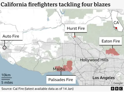
Progress has been made in containing the two largest fires burning across a combined total of about 40,000 acres.
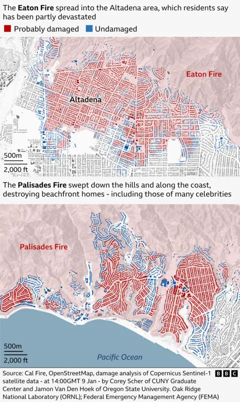
At least 25 people have been killed and more than 12,000 structures destroyed in some of the worst fires in memory to engulf America’s second biggest city.
The two largest fires, Eaton and Palisades, are still burning after more than a week – and firefighting help has been sought from Mexico and Canada.
Red flag warnings have been lifted by the National Weather Service (NWS), but could return in a few days.
There will be “a big improvement for tonight and tomorrow, though there’ll still be some lingering areas of concern,” Ryan Kittell of the NWS told news agency AFP.
Fire warnings remain critical with parts of southern California continuing to see an elevated risk despite the weakening winds and rising humidity, says BBC Weather forecaster Paul Goddard.
There is no rain forecast for California over the next week.
Officials are also keeping an eye on the Santa Ana winds, which have been blamed for stoking the blazes. The winds are forecast to return early next week, bringing a high risk of further red flag warnings.
Winds could bring gusts of 30-50mph (48-80km/h).
The Palisades Fire, the largest to burn, has seen no fire growth as firefighters work to contain the flames, according to Jim Hudson, a Cal Fire incident manager.
It has burned 24,000 acres. Over 20% has been contained as of Thursday morning.
“There are extreme hazards and extreme heat that still lie around the perimeter and the interior of this fire,” Mr Hudson said during a news conference in Malibu on Wednesday.
Mr Hudson added that 5,100 personnel had been assigned to contain the blaze.
“As we move forward we will continue to increase our containment when we feel it’s safe and that safety comes down to not only life and property, but also fire growth as well,” he added.

The 25th death from the fires was confirmed by the LA County Medical Examiner’s Office earlier this week. A number of other people remain missing.
Most of the victims have died in the Eaton Fire which has burned more than 14,000 acres to the city’s north. Firefighters have contained 45% of the fire.
Some of the victims of the Eaton Fire have now been allowed to return to their homes, but tens of thousands of people are still under evacuation orders – where night-time curfews also apply.
Thousands of homes have been destroyed in one of the costliest natural disasters in American history.
An extreme weather attribution study from climate scientists at ‘Climameter‘ has concluded that the Californian wildfires have been fuelled by meteorological conditions strengthened by human-induced climate change.
The study found that current conditions have been warmer, drier and windier compared with the past, in the areas affected by the fires.


